OTHER VKFF REFERENCE AREAS ON FLINDERS ISLAND.
Whilst on Flinders Island, the VK5FIL operators will also be activating two other VKFF reference areas, under their own callsigns.
This will be dependant on weather conditions.
Please monitor the parksnpeaks website and the DX Cluster.
This will be dependant on weather conditions.
Please monitor the parksnpeaks website and the DX Cluster.
Heritage Agreement (No. HA100) VKFF-4307
Flinders Island contains a Heritage Agreement (No. HA1003) which is a strip of land along the north coast of the island extending west from the island’s most northerly headland, Point Malcolm. The Heritage agreement is 279 hectares (690 acres) in size and was gazetted on the 29th day of August 1995.
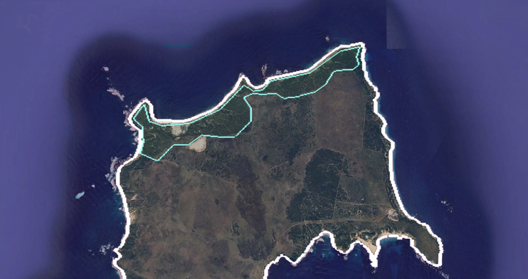
Above:- Heritage Agreement HA1003 (VKFF-4307). Image c/o Google Earth.
Investigator Marine Park VKFF-1717
Since 2012, the waters adjoining Flinders Island have been part of the Investigator Marine Park.
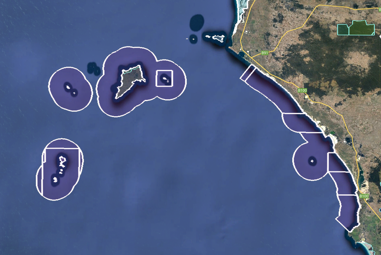
Above:- The Investigator Marine Park (VKFF-1717). Image c/o Google Earth.
References.
- CAPAD 2022.
- Wikipedia, 2024, <https://en.wikipedia.org/wiki/Flinders_Island_(South_Australia)>, viewed 14th January 2024.
